Antenna Direction and Azimuth Map
The antenna of an 11-meter DXer is in many cases a directional antenna, and even if it's not a beam (It might be a horizontal dipole or a loop antenna.) it's good to know something about antenna directions on a world scale.
When you are looking at an ordinary world map, the directions you see on the map from one point to another are not real antenna directions (north and south pole areas are distorted). The earth is a sphere in shape, and it is impossible to present it on a map that is printed on a flat surface without distortion in either distances, areas, shapes, or directions. Because of this, there are different projection methods used when creating maps, and the projection method used depends on which one of these things we want to represent correctly. For example, if you look on a normal map, Australia seems to be in the southeast direction from Finland even though the real antenna direction to Australia is somewhere between 65° and 100° which is about the east.
If you put a rope on a globe between these faraway locations and your own QTH, you will get the real great circle route to that location, i.e. the real direction. Azimuth map is a world map that has been set so that all the directions on that map are real antenna directions from one central point.
An Azimuth Map with Vaasa, Finland (KP03TC) in the Center
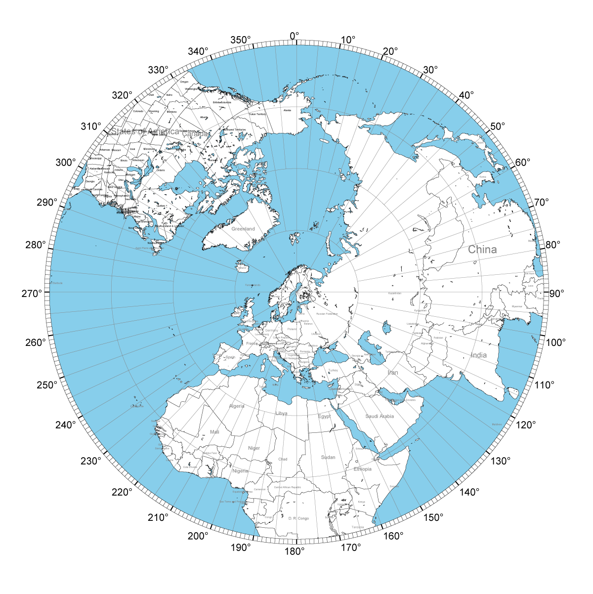
A4-sized azimuth maps in PDF-format with different radii, Vaasa is the center point:
- Radius 8000 km: AzimuthalMap_A4_8000.PDF
- Radius 12000 km: AzimuthalMap_A4_12000.PDF
- Radius 16000 km: AzimuthalMap_A4_16000.PDF
- Radius 20000 km: AzimuthalMap_A4_20000.PDF
The maps have been made using the online service at http://ns6t.net/azimuth/azimuth.html
The ready-made maps on this page are valid for locations that are about 600 km from Vaasa in maximum. You can create a map with your own QTH in the center using this service when you know the latitude and longitude or the locator of your QTH. If you live in a big city, you can also try entering your city name. You can also select the radius you want for the map.
Signals coming via Long Path (LP), which is the longer route to a location around the globe, are coming 180° from the antenna direction of that country, i.e. from the opposite direction. Usually, the antenna directions seen on an azimuth map for different locations are correct, but sometimes the radio wave can arrive via such a route that the direction on the azimuth map is not correct.
There are also several programs for creating azimuth maps, which you can install on your PC. One of these is Tonne Sofware's Pizza.
The online service at http://www.njdxa.org/dx-tools/beam-headings.php gives a list of antenna directions to all countries from your QTH when you give the latitude and longitude of your QTH, but after I tested the service myself I noticed that at least for my QTH it gives false antenna directions when compared to PC programs used to create azimuth maps.
Other programs and sites for determining antenna direction: http://www.ac6v.com/opaids.htm#GCM